-
- Site Description
- Soils Atlas
- Vegetation Cover
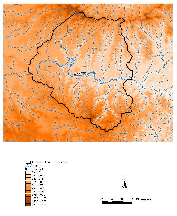
- Elevation Map
- Soil moisture sites
- Stream gauge sites
- Climate monitoring stations
- SASMAS Home
- Goulburn Experiment Portal
- Site Description
Elevation Map
Elevation data from the Australian 9 second (250m) resolution digital elevation model.